Of moose, a monument and a devastated port town:
Driving the Trans-Canada Highway in Newfoundland.

There’s no sign to mark the easternmost point of the Trans-Canada Highway in Newfoundland. Downtown St. John’s used to have the Mile One Centre, an arena near where the original highway began at city hall, but it’s now called the Mary Brown’s Centre. Then there’s the Terry Fox monument, a beautiful, introspective statue of the inspirational runner. It’s at the spot beside the harbour where Fox dipped his artificial leg into the Atlantic Ocean in 1980 and began his Marathon of Hope to fund cancer research, but he wasn’t near Canada’s national highway.
Mark Richardson is driving the length of the Trans-Canada Highway from St. John’s to Victoria. This is his first report of a seven-part series.
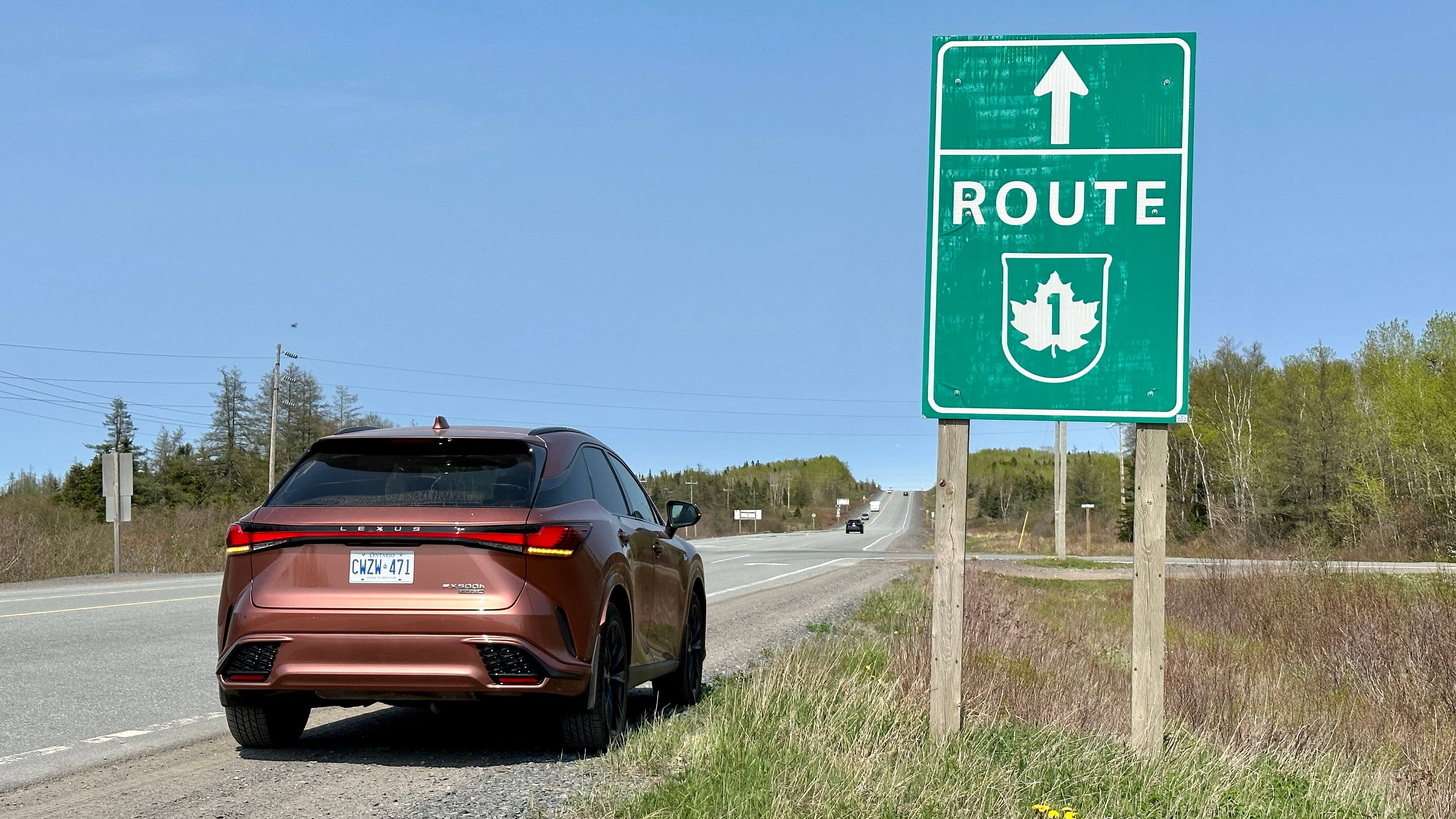
No, the Trans-Canada Highway in Newfoundland officially begins about three kilometres north of Quidi Vidi Lake and just up the road from the municipal garbage dump. That’s where the road widens and small green signs point you west on Highway 1 to lead you more than 900 kilometres across the province, and almost 8,000 kilometres across Canada to Victoria on Vancouver Island.
@globedrive Mark Richardson starts his Trans-Canada Highway drive by dipping the tires in the Atlantic Ocean #transcanadahighway #roadtrip ♬ original sound - Globedrive
Many of the signs beside the highway here warn of moose. The province estimates there are more than 100,000 of the giant animals roaming free, and when they get on the road, they can cause catastrophic damage to any vehicle that hits them. It’s the first question most Newfoundlanders asked when they heard I was driving the length of the Trans-Canada this month: “Seen any moose?”
No, I’d say, and then they’d tell me about their own close call. Sometimes, they weren’t so lucky.
Eleven years ago, I drove the entire Trans-Canada Highway to mark its 50th anniversary. It was opened on the same day I was born – July 30, 1962 – so the long drive seemed fitting. On that trip, I met with Michelle Higgins at her home in Norris Arm, not too far up the highway from Gander. She described how she’d hit a moose on the highway and carried on driving for 30 kilometres, not realizing her car was crushed and her neck was broken. She had no recollection of it.

Michelle Higgins’ car in 2012, destroyed when she hit a moose on the Trans-Canada Highway.The Globe and Mail
We met again a couple of days ago, and she told me she’d locked down her Facebook account because of the people who would contact her from around the world to ask her, the lucky woman, to pray for them.
One person who did find her, though, was a fisherman from Conche, on Newfoundland’s northern peninsula, after he hit a moose three years later.
“He said he never believed my story,” she said. “Him and his dad were sitting out on the front porch when my story was aired [on the radio] and they said, ‘That’s crazy. There’s no way that could happen.’” In Stephen Bromley’s case, however, he drove about 20 kilometres before another driver flagged him down in his wrecked vehicle, showed him the blood and hair and damage, and persuaded him to go to hospital.
Higgins and Bromley became Facebook friends before meeting several years later for a coffee. They’ve been together ever since.
Her home at Norris Arm is about 40 kilometres east of Grand Falls-Windsor, which is in the middle of the island. The actual centre point of Newfoundland’s section of the Trans-Canada Highway is 15 kilometres west of the town, and it’s for sale.
It’s just two acres of gravel next to the paved highway, with an asphalt drive leading to it up the hill, but in 1966, it was the place where a convoy of dignitaries driving from St. John’s met a convoy of dignitaries coming east from Port aux Basques, and where Newfoundland’s stretch of the Trans-Canada Highway was finally declared finished. It had been pronounced open several years earlier, but it was an awful road then: mostly gravel, narrow, winding and bumpy. The circus cancelled a visit to St. John’s in 1963 because the highway bridges couldn’t support the weight of its loaded trucks, and the elephants would have been forced to walk across them on foot.

Left: Mark Richardson in the Lexus RX500h, with its rear wheels dipped in the Atlantic Ocean at the Quidi Vidi gut at St. John’s, about to drive across Canada.
Right: The Lexus RX500h on the Trans-Canada Highway in Newfoundland.
The federal government originally offered to pay half the costs of a highway built to national standards, and all the other provinces had eventually agreed to pay the other half, but not Newfoundland, under the leadership of beloved former premier Joey Smallwood. He said there were more pressing concerns for Canada’s newest and poorest province, like hospitals and schools, and he held out long enough for then-prime minister Lester Pearson to pony up 90 per cent of the cost to get it built and paved.
In canny gratitude, signs were erected along the highway that declared, “We finished the drive in ‘65, thanks to Mr. Pearson,” and the prime minister travelled in the convoy from Port aux Basques to meet the premier, who drove from St. John’s. A 25-metre granite monument was created at the halfway point to mark the occasion and the site was named Pearson’s Peak. There were smiles and handshakes for the press, and then everyone went home.
There’s nothing there now. It was demolished in 1997. Ron Barrington spent four months working to build the monument as a labourer and he sheds no tears for it.
“It seemed to be a waste of money,” he said at his home nearby in Badger. “It just became a garbage dump, people bringing in beer and leaving a mess.”
Terry Best, however, did have happy memories of visiting the monument as a young teenager and hanging out there with friends, collecting beer bottles to earn a little extra income. He liked it so much that he asked the province if he could buy the land, and took ownership in 2002.

Realtor Darryl Butt sits on what is left of the 25-metre monument called Pearson’s Peak, near Grand Falls, N.L.Mark Richardson/The Globe and Mail
“It was my intention to build a small tourist lodge up there, with a huge chimney in the very front that was going to mimic the old monument,” he said. “It took years to get the approval, and by the time I got the approval, I had medical problems. So I just hung onto the place, thinking that one day … .”
Now, though, he’s given up on it and moved on – literally, to a new home in Windsor, Ont. He’s asking $29,000 for the land, with frontage onto a salmon-fishing river and across the highway from the old railbed, which is now an ATV trail across the province.
Realtor Darryl Butt thinks it might be a tough sell because the land is only designated for uses connected to tourism, such as a lodge or a motel, but Best is hopeful that enough people will remember the welcome sight of the monument and have an interest in it.
Of course, there’s still another 463 kilometres before the end of Newfoundland’s stretch of the highway, and that’s at the ferry terminal in Port aux Basques. Unlike the forgotten monument, the ferry – which is officially part of the Trans-Canada Highway – means everything to the town, says René Roy, the editor of the local Wreckhouse Weekly newspaper.


Right: A cleared area of Water Street in Port aux Basques, N.L. that once held home that were destroyed by Hurricane Fiona in September, 2022.
Left: The ferry at Port au Basques, N.L. that connects to North Sydney in Nova Scotia is officially considered to be a part of the Trans-Canada Highway.
“The only reason Port aux Basques is here is because that ferry’s here,” he says. “There’s no fishing any more. The harbour used to be full of hundreds of boats, but now you get maybe a rowboat or two. The only reason Port aux Basques remains is because of the highway, but these days, people get off the boat and they’re gone.”
The town was isolated early last year when rainstorms washed out a section of the Trans-Canada Highway, and some residents needed to be taken by helicopter to medical services in larger towns on the island’s west coast. Then it was devastated last September when post-tropical storm Fiona destroyed more than 100 homes.
Roy took me on a tour of the area hit hardest, and he spoke of washed-away homes and land as we walked through the fog. We met a couple whose home was spared but which now looks out onto a derelict house next door. After 54 years of living in his home, and working at the ferry yard for Marine Atlantic since 1960, Elias Osmond says he’d like to move, but nobody will buy his property. Insurance companies have denied all compensation. His wife Margaret says the wind now keeps her awake at night. She walks from window to window, imagining the worst.

Journalist Rene Roy stands on Water Street in Port aux Basques, N.L. in front of a cleared area that once held homes that were destroyed by Hurricane Fiona in September, 2022.Mark Richardson/The Globe and Mail
“I can’t even think of us staying here for another winter,” she says. “The waves are getting higher. I can’t handle it. But we’re still alive.”
They won’t leave town, though. It’s their home, connected to the rest of Canada by the national highway. It is this unifying piece of asphalt that connects their story to the rest of the stories I will be sharing over the next month and, really, the stories of all Canadians.
When I drove the Trans-Canada Highway in 2012, I travelled in a Chevrolet Camaro convertible. This time, I’m older and perhaps wiser, driving in a comfortable Lexus RX500h SUV provided by Lexus Canada. I drove it east from where it’s manufactured in Cambridge, Ont., dipped its wheels in the Atlantic at St. John’s, and now it’s taken me more than 5,500 kilometres.
For much of that distance, the Lexus was driving itself. Its semi-autonomous driving is capable on the highway, and once I set the active cruise control, I rarely needed to touch the pedals. The steering wheel is touch sensitive, so I just need to rest a finger against it for it to steer me down the road. There’s a camera that monitors the driver’s eyes and a warning will beep annoyingly if you take your eyes off the road in front for too long.
I let my friend Peter drive the car and bit my tongue when I saw he held the wheel wrong: left hand on the 2 o’clock position and right hand in his lap. (The correct position for swift reaction is either 10 and 2, or 9 and 3.) The Lexus, however, had no problem correcting him and beeped constantly. He was inadvertently blocking the camera’s view of his eyes with his arm.
“All my life, I’ve driven with my left hand on the top of the wheel,” he said. “I guess if I owned this car, that would have to stop.”
It would, and a good thing too, like it or not.
Mark Richardson is the author of Canada’s Road: A journey on the Trans-Canada Highway from St. John’s to Victoria (Dundurn).
Read more in this series:
A bridge, a ferry and a dot-matrix printer: Driving the Trans-Canada highway through the Maritimes
Stay on top of all our Drive stories. We have a Drive newsletter covering car reviews, innovative new cars and the ups and downs of everyday driving. Sign up today.
 Mark Richardson