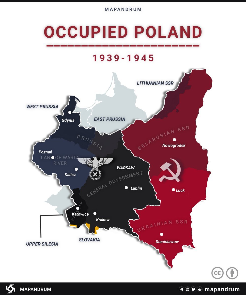
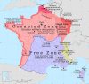
Occupied Poland, 1939-1945.
by
@mapandrum
Related Posts


 kinard-buckley reblogged this from k-i-l-l-e-r-b-e-e-6-9
  finntrollka liked this
  therockywhorerpictureshow liked this
  atleastitsnotasbestos liked this
  lucifer-and-demons liked this
  the-arkham-14 reblogged this from k-i-l-l-e-r-b-e-e-6-9 the-arkham-14 liked this
  maso-kist liked this
  k-i-l-l-e-r-b-e-e-6-9 reblogged this from mapsontheweb k-i-l-l-e-r-b-e-e-6-9 liked this alan00-0 liked this
  hrudall liked this jesmx5 liked this
  erikag59 liked this ssg2007 liked this
  mapstories reblogged this from mapsontheweb tzhrslf liked this
  splitposting2501 liked this
  mevrim liked this
  sugoiney-weaver reblogged this from mapsontheweb
  publiusmaximum reblogged this from mapsontheweb publiusmaximum liked this purplesuitcasesportsfestival liked this heikant liked this
  rhaenyrahightowers liked this
  brittany-its-bitch liked this
  blobmit liked this
  pressureunder liked this
  theinternetismywilltolive liked this
  obeythefloof liked this